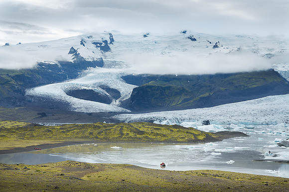
Fjallsárlón is a quiet glacier lake at the south end of the Icelandic glacier Vatnajökull. Fjallsjökull, which is part of the bigger glacier Vatna, reaches down to the water of the lake and calving icebergs are drifting by on the lake. The lagoon is a part of Vatnajökull National Park and the better known glacier lake Jökulsárlón is visible to the east from here. Above the lake looms the famous volcano Öræfajökull. It is the largest active volcano in the country, and on the summit crater's north-western rim is Hvannadalshnúkur, the highest peak in Iceland at 6,920 ft. Geographically, Öræfajökull is considered part of Vatnajökull, and the area covered by glacier is within the boundary of Vatnajökull National Park. Öræfajökull has erupted twice in historical times. In 1362, the volcano erupted explosively, with huge amounts of material being ejected. The district was destroyed by floods and falling debris. More than 40 years passed before people again settled the area. An eruption in August 1727-28 was smaller, though floods are known to have caused three fatalities. Next spread: panorama of Fjallsárlón.